
Until 2018, scientists could find better terrain maps of Mars than they had of Antarctica.
Now, with software engineering, code optimization and parallel software development assistance from the Ohio Supercomputer Center (OSC), they have “the highest-resolution terrain map by far of any continent,” according to Ian Howat, Ph.D.
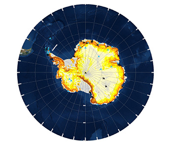
Howat is a professor of earth sciences and director of the Byrd Polar and Climate Research Center at The Ohio State University, as well as the leader of a mapping project called The Reference Elevation Model of Antarctica (REMA).
“At this resolution, you can see almost everything. We can actually see variations in the snow in some places. We will be able to measure changes in the surface of the continent over time,” said Howat. “We will see changes in snow cover, changes in the motion of ice, be able to monitor river discharge, flooding and volcanoes and to see the thinning of glaciers.”
The model’s total file size is more than 150 terabytes, or 150,000 gigabytes, which is precise enough to allow scientific teams to plan some trips over the continent’s treacherous terrain.
“We had to start from scratch to build this. The software had to filter the data, process it and turn it into a refined product for the scientific and broader community to use,” Howat said.
The project began with images taken from a constellation of polar-orbiting satellites. Using the opensource Surface Extraction from TIN-based Searchspace Minimization (SETSM) software, developed at Ohio State by Howat and MyoungJong Noh, Ph.D., the images were processed into Digital Elevation Models. For this data-intensive process, Howat and his colleagues used the petascale Blue Waters supercomputer located at the National Center for Supercomputing Applications in Illinois.
“Dr. Howat has used OSC systems for earlier terrain mapping projects, including one that examined the melting Greenland ice sheet in 2014 and another that aided disaster relief assistance following Nepal's 2015 earthquake,” said Karen Tomko, Ph.D., OSC’s director of research software applications and manager of the scientific applications group.
Members of Tomko’s group (Judith Gardiner, Ph.D., and Samuel Khuvis, Ph.D.) have been collaborating on software development with Howat and Noh, co-principal investigator of the grant. “The REMA project was better suited for a petascale system, and we were pleased to help them scale the code accordingly,” Tomko said.
Other collaborators on the project included the Polar Geospatial Center at the University of Minnesota.
_____________
PROJECT LEAD // Ian Howat, Ph.D., The Ohio State University
RESEARCH TITLE // Automated, high resolution terrain generation for
XSEDE FUNDING SOURCES // National Geospatial-Intelligence Agency, National Science Foundation
WEBSITE // byrd.osu.edu/people/howat.4