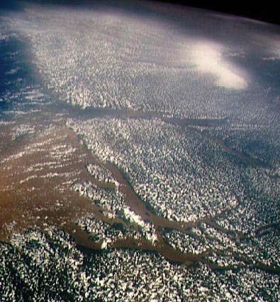
The vast fresh-water Amazon floodplain plays an important role in climate changes, biogeochemical fluxes, wetlands ecology and flood hazards. Yet, scientists really don’t know exactly how much water courses through the world’s largest river.
Building on his earlier work modeling flood patterns of the Amazon, Ohio State University Earth scientist Doug Alsdorf, Ph.D., has joined colleagues at the University of Bristol, the University of Washington and the NASA Jet Propulsion Laboratory to better understand the dynamics of the Amazon.
NASA’s proposed Surface Water and Ocean Topography (SWOT) satellite mission, with a launch expected 2013-16, will use radar altimetry to provide high-spatial resolution, global measurements of ocean surface topography and surface water elevations. For the terrestrial branch of the mission, SWOT will measure water storage changes in all rivers, lakes and wetlands.
Using Ohio Supercomputer Center resources, Dr. Alsdorf and fellow OSU research scientist Michael Durand, Ph.D., plan to incorporate those measurements into the LISFLOOD-FP hydrodynamic computer model to more accurately estimate river depth and slope, which are needed to calculate the waterway’s discharge. OSC researcher Judy Gardiner, Ph.D., adapted the program to the parallel processing platform of the Center’s IBM Cluster 1350.
“Fresh water is a basic requirement for life, yet surprisingly, our knowledge of the volume and fluxes of water on floodplains and in rivers is poor,” said Dr. Alsdorf. “Using synthetically produced SWOT measurements in two proof-of-concept experiments, we found that we will be able to estimate river depth and slope to within fractions of a meter and centimeters-per-kilometer, respectively."
--
Project leads: Doug Alsdorf, Ph.D., & Michael T. Durand, Ph.D., The Ohio State University
Research title: Assimilation of wide swath altimetry
Funding sources: NASA Terrestrial Hydrology Program, NASA Physical Oceanography Program & The Ohio State University Climate Water Carbon program
